Tourist route 1
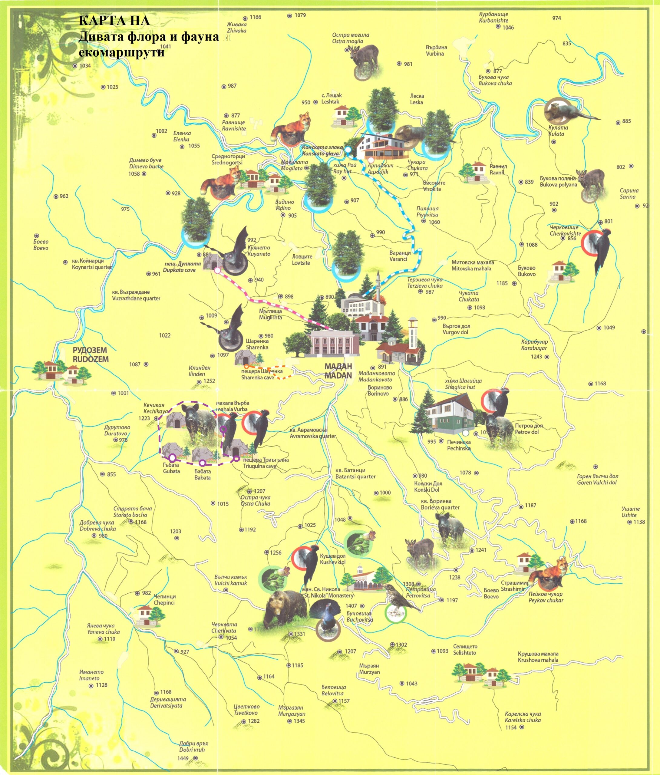
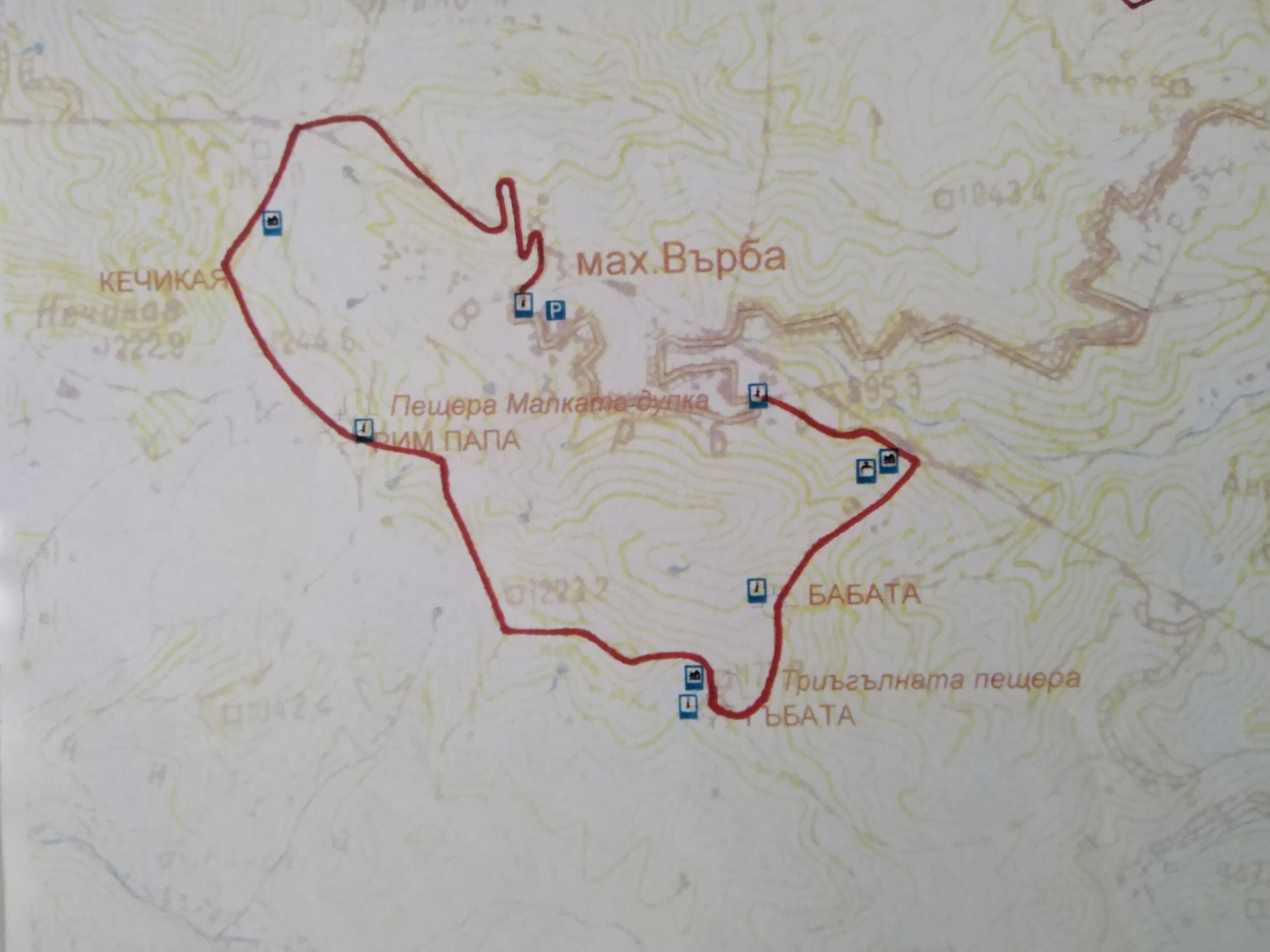
The route starts from the Information Zone and is 5.8 km long. It passes through the village of Varba and continues to the locality "Kechikaya", which is located between the municipalities of Madan and Rudozem. The "Kechikaya" area is a proto-Bulgarian fortress, occupied by the Romans. There are preserved many old stone walls of buildings and of a fortress wall. The route continues to the rock sanctuary "Rome Pope" with a height of 50 m., which looks like a man with a mantle. The cave "Malkata dupka" is located near the "Rim Pope" rock sanctuary. After a short rest, the tourists head to the "Mushroom" rock sanctuary, the "Triangular Cave" and the holy spring, which is located at the lower end of the rock sanctuary. The route continues to the "Babata" rock sanctuary and the Roman gallery.
Tourist route 2
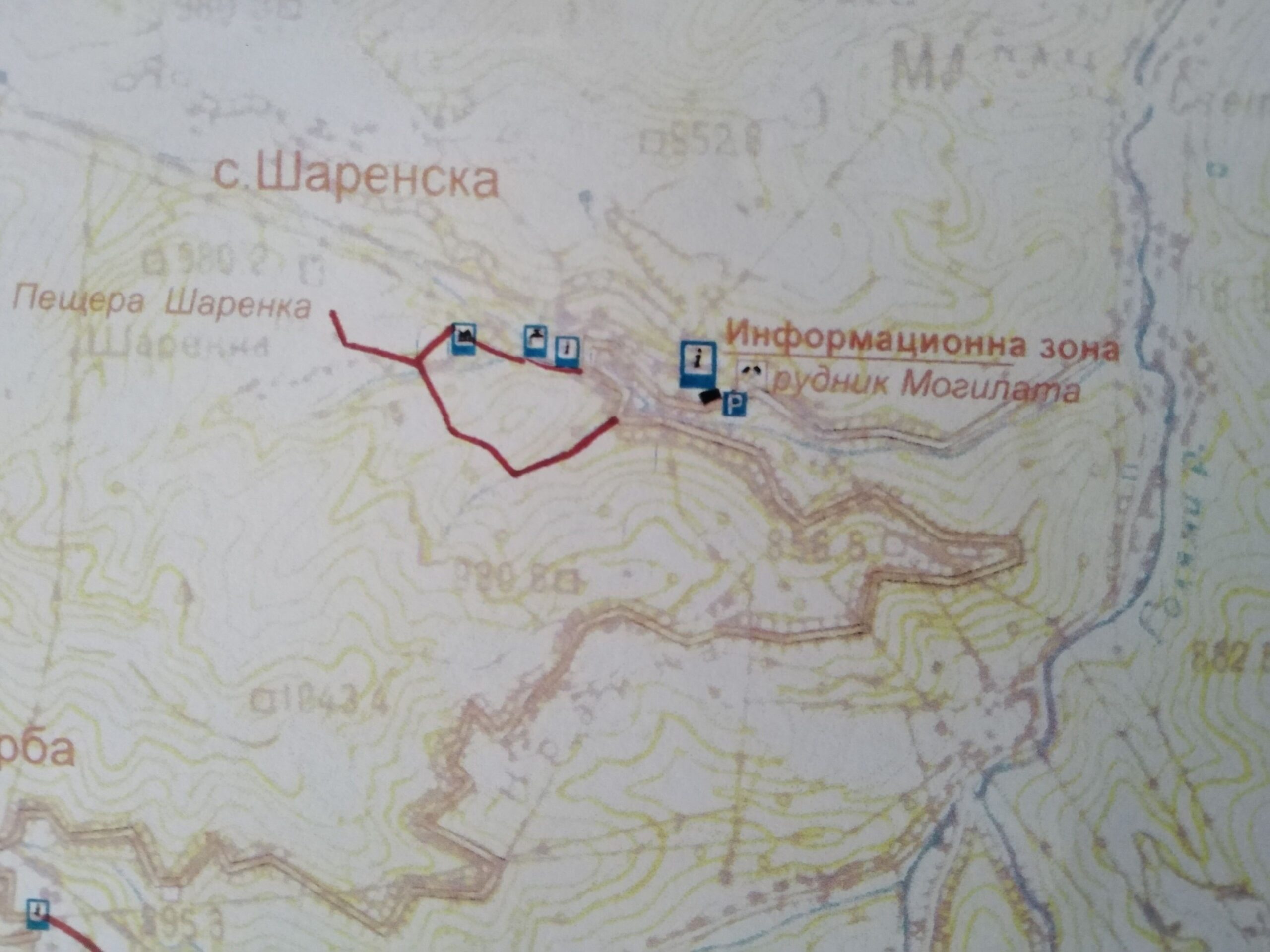
The route starts from the Information Zone and is 1.1 km long. It continues to the cave "Sharenka", which was inhabited during the Iron Age and the late Middle Ages. There is a hearth in the cave with cast pieces of mine, as well as traces of their heating. This is evidence of the presence of ore activities in the past as well. Fragmentary Early Iron Age pottery was also observed. There is a waterfall opposite the cave entrance. Near the cave there is a large garden gazebo with a fountain.
Tourist route 3
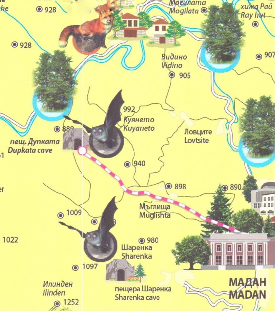
The "Madan - Dupkata cave" eco-trail has a total length of 5.50 km. It starts from the western edge of the town of Madan, passes through the center of the neighboring village of Maglishta and reaches the "Dupkata" cave. It has a total length of 107 m. and shortly after its entrance, the cave splits into two branches. The first is very short and narrow. The second leads to a large hall with an underground lake. The cave is home to four protected bat species.
Tourist route 4
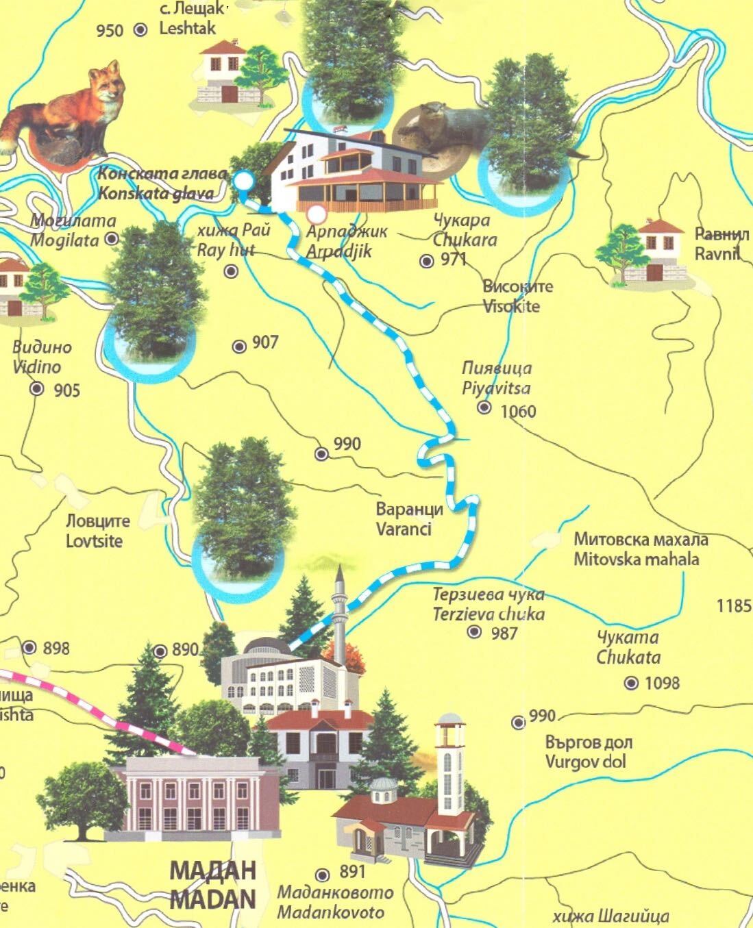
The "Madan - Konska Glava" eco-route has a total length of 10,750 km. It starts from the eastern end of the town of Madan, passes through the neighboring village of Arpajik and ends at the rock massif "The Horse's Head". This is a natural phenomenon located next to a huge chasm with a depth of about 100m. The rocks provide a perfect opportunity for photo-hunting, as from this place you can see beautiful views of the Arda River, as well as various species of animals and birds. On an even steeper terrain, the route continues towards the river and reaches a wooden decorative bridge with a width of 1.5 m. On this bridge, you cross the river and reach the main road to the town of Kardjali. Turning back, any eyewitness would hold their breath at the incredible sight that appeared before their eyes. A huge horse's head rises majestically above the river, proudly towering above the trees. This wonderful natural corner is the end of the eco-route.
